Showing posts with label cycling. Show all posts

Tuesday, 23 June 2015

The Fred Whitton Challenge

It's been a shameful while since I wrote about one of my cycling adventures, but the one I did yesterday deserves a write up. The Fred Whitton Challenge, for those who don't know, is a famously hard ride in the English Lake District. It is named after a chap who was secretary of the Lakes Road Club and who sadly passed away at the early age of 50 in 1998. In it's current form, the ride is 112 miles long and involves about 3700m of vertical ascent, going over many of the major Lakeland passes, which are bad enough to get over in cars, never mind ride over on bikes. It is run as a sportive event each May, but there is always the option to do it outside of this event, which is what Sam and I did yesterday.

Needless to say it was very hard going in places. It was a long day in the saddle, perhaps the longest I've ever done. For me it did involve some walking, up the steepest gradients, but there are several reasons for that, which I may come to later.

Newlands Hause. The white speck is Sam.

Every year around the anniversary of my appointment with destiny (June 21) I try to do something to mark it. Plus it is Sam's 40th birthday next week, so here we are.

The route starts and finishes in Grasmere, but it is a loop so I suppose you could start anywhere. However I know a nice hotel in Grasmere, The Swan, so Sam and I stayed there on Sunday night. We wanted to leave early but breakfast was at 8 so we couldn't. One of the reasons for going 'on our own' was that we could choose whether to actually set off based on the weather. The past few years of the sportive have seen some horrific weather, which, I think, makes this ride quite dangerous as well as a miserable experience. Rain is one thing, but imagine riding around these beautiful roads and not being able to see anything? No thanks.

We decided to do this ride on a Monday on purpose, for two reasons. Firstly, we figured there'd be a lot less traffic on these little tourist roads than on a weekend, and second, things would be open, think bike shops etc., should we need them.

The weather that greeted us on Monday morning when we woke up was about the worst possible from a decision-making point of view - light rain. Heavy rain = no. Sun, light cloud etc = yes. Light rain = ? The weather forecast was saying thunderstorms in the afternoon, light rain all day in Grasmere, Keswick and Eskdale. In other words, the whole ride in light rain. Not fun.

At about 9am it didn't look too bad so we went out and got everything ready. Not raining, good. Plan A was to set off and see how it went weather-wise. Because of the route, after about 20 miles in it is possible to return to Grasmere from Keswick quite easily until about half of the ride is over. After Whinlatter, more later, you're on the 'wrong' side of the Lakes and quitting from there is more difficult. So at the very least crossing Whinlatter is the 'point of no return', kind of. Anyway, flexibility is good.

I should say as usual I have spent a lot of time thinking about this ride, looking at the map etc., reading about it and other peoples' experiences of it, and I really wanted to do it. But, contrary to popular belief I am not an idiot and I was prepared to bail if I thought it wasn't sensible, even after 55 miles.

We had it in our minds that there were quite a few things that could go wrong apart from the weather; mechanical issues mostly. One thing neither of us thought about was road closures. So I laughed when we got to the bottom of the first climb of the route, up Holbeck Lane near Ambleside, to find a 'Road Closed' sign. At this point I was thinking we were doomed not to succeed today, and any idea we had of following the 'official' route exactly was now gone. We went south a bit to Troutbeck Bridge and turned left to Troutbeck to meet the closed road up the hill.

Road closed, honest. Not something we anticipated!

What this meant was that I biked along the fateful stretch of road past White Cross Bay for the first time. I wish I could say I remembered exactly where it happened, but I don't, I just know where it was because of the map the police gave me. Maybe it's better that I don't remember, what I do remember of it is bad enough I suppose!

Kirkstone Pass.

OK, official route rejoined at Troutbeck, now going on to join the Kirkstone pass road. This is a pretty easy climb akin to what we do in the Peak District, or what we did on the Dragon Ride two weeks ago, a steady gradient gaining height. At Kirkstone Summit there is the inn, and the junction with the road called 'The Struggle', which I thought the Fred Whitton went up but doesn't. So that one will have to wait for another day. Kirkstone Summit is the high point (elevation) of the whole ride, and right near the beginning, but even though the other summits are lower, getting to them is harder...
Dropping off Kirkstone into Patterdale was a good few easy miles, the descent fast because the road is obvious and visible. Some flat miles along Ullswater and then turning left a climb over  Matterdale End, affording great views back to the lake.

Looking back to Ullswater on the way up to Matterdale End.

Another drop down and we joined the A66. This is not a good road to ride a bike along. We could have taken the back road (and should have) but this would take longer of course. Needless to say I had quickly had enough of being passed by big lorries and fast cars, so at Threlkeld we came off it and went over the hill via Castlerigg Stone Circle, much better. Also we get to go through Keswick centre. I suppose the official route bypasses Keswick a bit and uses the A66 for time reasons, to make the whole route faster, but I think it should go on the back road, it's much nicer and safer. Deviation number two then from 'official'.

Anyone who knows the Fred Whitton knows that the first major obstacle is Honister Pass, which is about 7 miles south from Keswick. All the way along this road I am getting anxious about what we will face. Honister is famously hard. I should say I've never ridden any of these passes before, but 25% gradients are not good wherever they are. We could see some traffic coming down the road about a mile before we got to the base, and it is obviously very steep at first. At Seatoller an ominous road sign announces the impending ramp. Still, take it easy, and don't panic, it might be OK. Of course I knew Sam would disappear up the road, he's much stronger than me and has a multitude of other advantages over me which I might go into later on... anyway, that's not a problem. I just focus on myself and my own struggle. The first few minutes of the really steep bit were hard but out of the saddle I seemed to be doing OK. Then the killer that kills me every time, you round a little curve and see the gradient continue without relenting for another 150m or so. Beaten, psychologically I think. I still don't like unclipping, especially on a steep slope, but I did. I had to. I will say this again in this post, but next time I ride this road I will do better, because I will know what's coming. I have heard it said that it's better not to know, which may be true for you, but for me it's always better to know.
So, now I've a new problem: I have to walk for a bit, until the gradient relents enough for me to get back on the bike again. Walking for me is hard, in cleats is harder still, up hills is harder still. So I swap one form of physical suffering for another. Remember: I'm here voluntarily, nobody has coerced me into this, I could be at home (at work actually it's Monday) but I'm not, I'm here on a 25% slope struggling to push my bike and trying to keep my left foot in the shoe because it doesn't stay in... I was never going to lose it mentally, it's just really hard, especially knowing Sam has danced up here minutes ago.

Having a rest on Honister Pass.

OK, the gradient has slackened off a bit, so I can get back on, and now I see what I wanted to know and what will make me do it next time: there's a flat(ish) bit here where you can recover before the next slope. The next slope which is hard but not 25%, so rideable, and ride it I did. The top of Honister has a Youth Hostel, what an awesome location, and a ski-resort style cafe. Stopped for a picture, then off over the other side. This descent was steep but not too bad, of course we had good visibility and dry roads, but it was fun dropping down into Buttermere. I like Honister Pass actually and I know I can get up this properly now that I know what it is like.

Sam at the top of Honister Pass, with the superbly located Youth Hostel.
Looking to the left on the Newlands Hause road.

At Buttermere a right turn signals the start of the second major pass of the day, Newlands Hause. This is famous for being a road that's carved right across the slope of a big hill, steep slope up on your right, steep down on your left. I knew that round the bend I could see, it continues, so the bend is not the top, so I couldn't be knackered there. But, very different from Honister, I can see the road from afar so I can see where the efforts are and where the recover points are. So even though I again watched Sam disappear in the distance, I was confident I could ride this. I did stop to take pictures, but by choice (honest) (no, honestly). There are a couple of nasty little bends after the bend you can see from a distance, but you know the top is there so you can max out on those knowing you'll get a rest. Looking down the other side, great feeling knowing there's a good few miles of downhill ahead, almost all the way to Braithwaite.

The way ahead from the summit of Newlands Hause.


Things were not looking promising on the way up Whinlatter Pass.

Braithwate, turn left, up Whinlatter Pass, a doddle in comparison. Well, it is, but now we're both getting a bit hungry and the plan A of having lunch at Whinlatter Forest Park has gone wrong slightly insofar as it has taken us a lot longer to get here than we would have liked. We were both I think getting a little crabby, and the light rain had started to boot. On the way up this hill I was thinking hard about whether it was sensible to continue, this being my 'point of no return' really. The rain didn't really look like abating, but we were stopping anyway so no decision had to be taken yet.
Whinlatter Forest Park is a bike centre. The trails in the forest there are really good fun, high in altitude and in number. It is my favourite of the trail centres I've been to, and one day I will come back with the MTB and ride them again. Maybe soon! It is a mountain bike trail centre, but in the cafe they won't fill your bottles up, you have to go round the back to where the toilets are and use the water fountain. This, even if you are buying your lunch and sitting down inside. I think that's a bit mean.

It was 3 o'clock, and we both knew that it was going to be a late finish now, maybe 8 or 9 o'clock. 58 miles down, 55 miles to go (although we thought 50). On the plus side, the section between here, Whinlatter Summit, and Eskdale has two climbs on it but otherwise should be quite fast. After we had eaten and had coffee, refilled our bottles and so on, the rain had gone away and now it didn't really look like returning. This, now I think about it, was kind of a miracle. When we walked in I wasn't sure we'd be carrying on. When we walked out all doubt had disappeared. And it didn't rain again.
The next miles went quickly. I have not spent much time on that side of the Lakes, so I didn't really recognise any of the fells as we made our way past Loweswater and turned south. There's a hill called Fangs Brow to get over, and quickly enough a sharp descent to Croasdale with some hairpins on it that I feel sure must have caught out some riders in the past.

Lovely weather now on Fangs Brow.

After Ennerdale Bridge there's a climb onto and over Cold Fell, which is quite serious but actually was OK. When the gradient flattens out onto the moor this is a quite beautiful road. The sun was out now too, and there were Herdwick sheep a plenty. This was one of my favourite sections of the whole ride. Sure, the sun helps, but it was an exposed road with no traffic, easy ups and downs, moorland and sheep. Also horses.

The road to Cold Fell, one of my favourite stretches.

It's now that you know that the next proper uphill is the big one. Sure, there a little lump to get over at  Santon Bridge, through the woods, but your mind is already set on the inevitable. Arriving into Eskdale Green and just before the turn off towards Hard Knott, there was a pub where we stopped for a refuel. I did have a half, after 90 miles I felt it was OK ;) Also some jelly babies and water and a gel. We probably stopped here too long in hindsight. As soon as we started riding again I knew we couldn't stop again, my bottom was getting sore! 4 miles down this road is Hard Knott Pass. It's only 20 miles now to Grasmere, which normally would take about 90 minutes tops, but the difference here is you've got one of the hardest roads in the country to get up, and, by then, you've already ridden 95 miles.

The base of (very) Hard Knott Pass.

There is the obligatory road sign announcing that you're about to suffer, and the road kicks up. Really. You have to go over a cattle grid which is not big deal really, then there's a little layby which I rode into to try to reduce the gradient a bit, didn't really work. I look up and I can see the first right hand bend, but it may as well be a hundred miles away. I'm not strong enough for this, certainly not at this point. My mind gives up, I unclip. Walk up to the bend, OK I can get back on here. Taking it really slowly and measuring every pedal stroke. Problem - there's another really massive ramp ahead. Just keep calm. Halfway up this really steep bit I simply could not push/pull the pedal down, it was like the chain had stuck. I'm not good at unclipping at the best of times, but this was a new experience for me. I fell off. To the right and into a few nettles, but thankfully not over a 100ft drop. I lay there for a bit trying to get my left foot out of the pedal. OK. Walking now up this really steep bit. Next time I could get back on, decided not to clip my right foot in so that what just happened doesn't happen again. OK. Up the next steep bit, new problem. My left leg is not as strong as my right, it hasn't been since it was reconstructed and I think my mind protects it. So it doesn't work as much, and now, because my right foot is unclipped, it has to work more that it's used to. A really sharp pain in my inner thigh, cramp. Oh dear. Meanwhile Sam is probably at the summit cairn having a lie down. I got off, drank pretty much all the fluid I had left, stretched a bit. What if I get back on and it hurts the same? Don't know. Walk for a bit, OK. Hard Knott is like two passes really, there's the first miserable pitch, then it's reasonably flat for a bit and you can see the second steep bit ahead. I rode most of the flat bit, of course, and walked most of the second steep bit. I guess Sam had waited about half an hour for me. He managed to ride all the way up. How that is possible I do not know. I am not sure that even at my 'prime' whenever that was (2009/2010 probably) I could have got up this. It's simply unbelievably steep in places.

One of the benefits of having got off and walked (trying to find some positive here!) is that I could look back and take some pictures in the failing light, very nice. I'd rather have been able to bike up though. One of the benefits of it being quite late in the day is there was virtually no traffic.

Hard Knott summit cairn, looking ahead to Wrynose.

Next: descent off Hard Knott, steep but again nothing to worry about in the dry. In the wet this would have been a different story, but we were lucky with that. You're down at about 240m now, from ~390m at Hard Knott summit. Wrynose Pass is next and the last obstacle of the day woo hoo! You know the elevation change is not great, it can't be. I did have to walk up a bit of it, but not much, only the steep left hander, and I could easily do this were it not coming after 100 miles. Next time this one won't be a problem. You can see where the top is, that helps immensely.

Looking back to Hard Knott from Wrynose.

Sam feeling pleased with himself on Wrynose summit.

The rest is downhill, mostly, then a frivolous loop to Elterwater and bizarrely not going over Red Bank straight back to Grasmere but returning to Ambleside and taking the Rydal road north back to the main road. I think if it's going to Elterwater it should be to go over Red Bank, but hey. On the plus side that last few miles is very fast, as typically you unload any reserves of energy you have held back because you know the end is a mere 15 minutes away.

It was almost 10 o'clock when we got back to the hotel and the car. Elapsed time 12.5 hours, that's surely the longest I've ever been out on my bike for. Later I discovered that the moving time was 10h10m, which means were were stopped for 2h20m, much more than I would have guessed. 10 hours for this route is probably not too bad.

What have I learned?

This is an amazing ride, but in bad weather you need to forget it. Didn't I already know that? Yes I think I did, but doing it has reinforced that. If I entered the sportive and woke up and it was raining hard... Having said that, the forecast was bad, it looked bad both before we set off and halfway round, and it didn't turn out to be. Even more so that the Peak District I think, the Lake District has massively changeable and unpredictable weather. You could set off in bright sun and finish in heavy rain or vice versa. I think you have to be able to bail if it doesn't look good. Hard Knott would not be a good place to be in a storm. But, if you get to the base of Hard Knott and the weather turns, then what? I don't know. I think with this, you have to say a prayer beforehand that it will work out. We were very lucky with the weather, I know that. We didn't get wet even though the forecast was light rain all day, thunderstorms in the afternoon. To read how bad it can be, look no further than my super-fit triathlete friend John's account of his experience on the 2013 sportive.

I am unfit. I did not prepare for this in nearly as proper a way as I would have liked. Yet, I only really struggled when the gradient was above 20%. Conclusion, I am not strong enough to get up the steepest slopes. Didn't I already know that? Well, yes. I am not sure how much of it is lack of training and how much of it is the limit of what my legs can do now. Because I spent a silly amount of money on the Garmin Vector pedal-based power meters, I know that my left/right power balance over that ride was 44%-56%. After the next op, this is something I need to consciously work on, the strength in my left leg. Nevermind how fit I am overall, I have to pull my left leg up to somewhere more equal.

Cardiovascularly I must be OK. I've only ridden 500 miles this year, very unusual for me, and 200 of those were in the rides I did yesterday and the Dragon Ride two weeks ago. Preparation was not ideal, yet it wasn't endurance that made it hard.

Do I need a new bike? Probably. This one has served me well but I feel like it's had its day. I wonder if it didn't get a bit damaged in my accident on the Tour of the Peak and the rear mech is definitely bent a bit. It's not the bike's fault, but having a nice carbon machine like Sam's would certainly improve the chances of successfully getting up those slopes. I could lose kg off my body too of course.

I have finally sorted my in-ride eating, I think. I now find it a lot easier to know when to have a gel or munch on something, and now I don't seem to think I don't need to eat because I feel OK now, only to suffer later. I wasn't hungry once yesterday, or two weeks ago.

It feels like I'm being characteristically hard on myself. Doing the Fred Whitton challenge was this year's event to mark the anniversary of my accident, and as such it was a good choice. Having learned last week that I will be having another major operation in the autumn has affected me I'm sure, and I  guess I'm feeling a bit sorry for myself. How about this: when I recover next time, I'll recover stronger in my left leg, I'll buy a new carbon road bike, I'll go back and do this ride again and smash my times on these passes. That's better, positive :)

*UPDATE* After looking at some of the footage I got from my handlebar camera, it appears I didn't walk as much as I thought I had. Funny how these 'failures' sit large in the memory. Particularly on Hard Knott, I made it up a lot further than I remember, even though it was yesterday, before I had to have a rest.

Kirkstone Pass: no real problem, easy gradient steady climbing
Honister Pass: super steep at the beginning, rest, less steep bit to finish
Newlands Hause: steep but recovery possible, very steep but short after the bend
Whinlatter Pass: harder than I remember
Hard Knott Pass: impossibly steep, two major pitches with recovery possible in between
Wrynose Pass: from this side, steep but short

Fred Whitton Challenge: long ride made hard because of super steep climbs, not to be underestimated, not to be undertaken in bad weather.

Looking back to Eskdale from Hard Knott Pass.


Tuesday, 24 June 2014

Wiggle KiloToGo Flat Out in the Fens 2014

Well, that was the longest ride I've ever done by some way. But it wasn't boring, and it wasn't as hard as I thought it was going to be.

I mean, 152 miles was never going to be easy, but I was prepared for a real sufferfest which never happened. Good preparation? Good weather? New aerobars? Eating properly? Probably all of these. The weather I think was kind - I had expected it to be a lot windier, which would have made some of the long straight roads quite an ordeal I'm sure. Apparently last year it was like that, so again I have been lucky with the weather! It was hot and I had plenty of suncream on, especially on my left leg which is essentially now just one big scar below the knee. I need to find out whether it's OK to have it in the sun a lot, or whether there's still some risk I'm running by doing that. Anyway, I put loads of factor 50 on it so should've been OK.

On the start line, at Peterborough Regional Centre.

As I said in my pre-ride musings post from last week, I really had no idea what to expect from this ride time or pain wise. I guess I was preparing myself for the worst. Pretty early on though it became clear that I was going to finish this ride somewhat quicker than I imagined, if I could keep the pedals turning! I was using my average speed to gauge my effort, in the first 30 or so miles up to the first feed station, the average was around 18 mph. Big groups of riders were passing me, something which continued through the day, but I wasn't tempted to join any of them. I know all the stuff about effort in a group etc., but I'm sorry to say I just don't like it very much - I don't like being so close to people and not being able to see the road properly in front of me. One or two people is OK, but more than 5 and I'm getting nervous. Plus, these groups were going at about 21 mph, which even factoring in the saved effort is too fast for me I think. I kept reminding myself that my race was with myself, not with anyone else.

In terms of eating, I decided to stop at all 4 feed stations and make sure I was eating along the way. I think I ate more on this ride than I've ever done before, because I was concerned about the bit between 110 and 152, i.e. the end, and how tired I would be. I didn't want to struggle because I had been stupid and not eaten enough. I also thought that signal permitting I could send tweets and texts to Mum and Rebecca from these points.

The stops were at 29, 67, 95 and 130 miles. At all these points I refilled my two bottles, most times with OTE energy drink from sachets I was carrying. I made sure to eat two of the things on offer at each stop; small size cheese and onion pasties, sausage rolls, sandwiches, cakes, half bananas. This was on top of the 3 Mule Bars, one OTE Duo Bar, one packet of Powerbar Shots, 2 OTE energy gels and 2 OTE caffeine gels I ate on the move. The caffeine gels are awesome - I saved these for near the end and had one at 110 miles and the other at 140. They give you a nice boost.

It was the first time I've ridden with aerobars. I got them specially for this ride because of all the long, flat, straight roads. They're brilliant. Apart from anything they give you another position to be in, to be able to keep shifting around every now and again and stay loose. On top of that I think they give about an extra 1-2 mph. This ride was great because I was able to think about and test that during the day. I won't use them all the time, but on rides like this, and the one I'll do with Tijl in Belgium next month, I think they'll be really useful. They're Profile T3 Plus bars from Wiggle, in case you're interested.

The route was not boring. There really are some super straight roads in the Fens though - one of the stretches was, I think, nearly 7 miles straight as an arrow. Wow. The sky is big round there and there were also lots of villages on the way. Lots of interesting water management works too, engineering stuff that reminded me a lot of the Netherlands. Probably the best stretch I can recall without thought was the bit along the River Great Ouse up to Downham Market.

Time-wise I could see after about 50 miles that I was going to do quite well compared to my expectation. I had it worked out by that point that I would have to have a major problem not to end up with a Silver time for this ride, a bit surprising since on the other KiloToGo rides this year I've not even managed Bronze. I think the weather must have been a factor, but having said that I did feel good most of the way, so maybe the training has helped :)

I got a few comments about my Holme Moss jersey, which I wore on purpose as a sign that I'm from a place with big hills. Some guys from Wakefield passed me and let on.

At the end I was able to have a sit down and reflect on the previous 9 hours and 15 minutes. Lots of easy miles was my conclusion, just that there was 152 of them! I wasn't expecting to feel like this, but I think I might do this one again! There was something very different about it, but also very good. You are able to get completely in the zone, it is very relaxing. This is going to sound very silly, but at a couple of points I was actually fleetingly worried about falling asleep.

Resting at the end. Aerobars are brilliant.
Afterwards I had a rest, ate a flapjack, and drove back to the hotel, The Bell Inn in Stilton for a shower. The day ended with a few beers, some phone calls, internet and strava updating and a big juicy burger with stilton on it and chips. Mmmm. I checked my justgiving donation page - link to the right of this page - and it was up to about 450 pounds raised for the North West Air Ambulance. That's great!

Later, back at the hotel, a well-earned beer. Oakham Ales' Bishop's Farewell.

Here's my strava entry for the ride. I was very interested to hear what my friend Tijl would say after he saw this - "absolutely brilliant performance!" was his verdict, and who am I to argue? I won't be being hard on myself this time. My moving time was 8h 33m.


Wednesday, 18 June 2014

4 years on, KiloToGo Flat Out in the Fens pre-race thoughts

It's a special weekend this coming one. I'm off to the Fens, east from Peterborough, to ride the Wiggle KiloToGo Flat Out in the Fens sportive. I'm doing the 152 mile option, which will make this by some stretch the furthest I've ever ridden in a day, assuming I complete it of course :)

But it's special because it marks the 4th anniversary of my appointment with destiny, June 21, 2010. The World Cup has been reminding me of it too - I know I watched some of the last one from a hospital bed in Preston but I can't say I remember a right lot of it. Although as an England fan that may be a good thing ;) 

4 years on


Over the 4 years since several factors have returned me to the point where I can consider doing the kinds of rides I used to do, and even go beyond. In the first place there's the NHS, who saved me and put me back together, rebuilt my leg and followed up with me until just recently, to make sure I was as good as they could get me, for free. I suspect that most people in this country have no idea how lucky they are that we have the healthcare system we do. Long may it continue to be so. 

The encouragement of friends and family has been important. None of them have ever 'managed my expectations' which would have been a valid thing for them to try to do, but I guess they know me well enough to know it's not what I wanted. If I haven't already, I'd like to thank them all again for their support - knowing when not to speak as well as when to - and also to apologise again for putting them all through this in the first place.

Finally, and in a rare departure from my usual modest self, I know my attitude has been one of the most important factors. I have tried to stay as positive as I could throughout the whole episode, and for the most part I've succeeded. Last week some people who really didn't have to paid me a massive compliment by describing me as 'amazingly positive' and 'a shining light'. These were the guys from the insurance company, a matter which I'm pleased to say, 4 years on, is now behind me.

It's unlikely I'll ever run again, which crosses off all sorts of things as possible, but I can live with that, and you never know, right? I'll never go a day again without pain in my leg and ankle, but it's the price of being alive. I will probably have another operation in the next couple of years, to break my ankle a few times and hopefully make this pain more manageable, and walking a bit easier. I might have a few more operations to make my leg look nicer, but there's probably not a lot of point is there? The days of me being a leg model are over ;)

There have been moments where I've been really sad and have struggled - I still have flashes of it and there are some persistent and annoying symptoms of post-traumatic stress, but it was worst was when I couldn't ride. In the 895 days I couldn't ride my bike, sometimes it looked a long way off, but the truth is I never genuinely doubted - I knew I'd turn the pedals again eventually and I knew I wouldn't just turn them, I'd push.

And here we are.

Flat Out in the Fens


The furthest I've ever ridden in a day before was 108 miles in 2009 in Wales. Since then I've ridden 100 miles a bunch of times. What are the issues with this ride then? OK well it's flat. I did more climbing within 4 miles of my house the other day than I will do in the whole ride on Sunday. So that makes this one different. Flat brings two potential problems to my mind: first, you have to pedal pretty much the whole time. On a more normal ride you at least get to freewheel down hills if you want a rest, etc. Second, wind. There will be no protection from potentially strong winds. There may be many, many miles riding into a headwind. I don't like that at the best of times, but after 100+ miles that could be a killer.

Got my number and timing chip, and some new OTE bottles and smart bottle cages for the occasion.

Anything else? Well, yes. Eating and drinking. Of course there's the well-stocked feed stations as usual with KiloToGo rides, but availability of food is never my problem - it's eating it. This time I will have to be really disciplined and eat regularly. This is too far to push through I think. Sometimes by 90 miles I'm thinking - I'm hungry and aching a bit but only 10 miles to go... this time it will be 60. Yikes. It's a long way. I will aim to carry enough food with me for the whole ride as usual, and only use the feed stations as top up and to get water. I'll probably adopt my usual strategy of missing the first one altogether. If it's super hot I will need water, but that should be quick.

What else? Fundraising. This time I'm going to ride for the North West Air Ambulance. I didn't need them, but people involved in similar accidents to mine regularly do and regularly get saved by them. I think they're an extremely worthy cause and will for sure help people like me, so they count. I hope to raise a significant amount this time, even though I know people may be getting tired of sponsoring me now - I have to think about that for the future. As usual, you can donate by clicking the JustGiving link on the right hand side of this page.

My other thoughts at the moment to do with the ride are slight worries about pain in my ankle, my contact points (hands and bottom) and lower back. I'm not sure what state I will finish this one in! I'll probably take some Ibuprofen and Paracetamol with me and hope not to need it. Also we can hope that the weather will play ball again - no rain and no wind would be best!  Finally, I have no idea what time to expect or to aim for on this one. As I said, it'll be pedalling pretty much all the time which is not what I'm used to. I was thinking if I finish in 9 hours I'll be happy, but really I don't know if that's realistic or not. I guess we'll find out won't we!

My itinerary for the weekend is to leave on Friday lunchtime - on Friday night I'm staying with friends in Cambridge, who I haven't seen for a long time so that should be fun! Saturday and Sunday night I'm booked into The Bell Inn in Stilton - as in the cheese - that will be lovely I'm sure. On Saturday during the day I will go and find some pretty village to look around or something equally relaxing. When I get to the hotel I might ride for half an hour if the weather is appropriate. It's an early start on Sunday morning - I'm aiming for 7am on the start line - so I decided to stay Sunday night too, didn't fancy driving for 3 hours after this one! So I'll come back on Monday.

I'm sure it'll be a great weekend whatever happens on the ride. I will see another part of the country I've never really seen before and I hope that I can raise some money for a good cause at the same time. I will try my best to write a proper ride report as soon as possible afterwards. I know I'm not always very good at that!


Thursday, 1 May 2014

KiloToGo Cornwall Tor 2014 results as spreadsheet

Here's my spreadsheet of the results from the 2014 edition of KiloToGo's Cornwall Tor ride. With this you can order stuff to your heart's content. I added columns for route option (42,64,95) and gender (M,F).

Hope it's useful to someone!

https://www.dropbox.com/s/d0scwm12hikw62t/CornwallTor2014.xlsx

Friday, 25 April 2014

KiloToGo Cornwall Tor preparations

Tomorrow morning we're going down to Bodmin so I can take part in the KiloToGo Cornwall Tor ride on Sunday. The route looks fantastic - 95 miles out east from Bodmin to the south coast at Looe, then weaving back west and north to the north Cornish coast then back to Bodmin. Should be a fab day in the saddle.

Here's the route. kilotogo.com.


There's also loads to do round there so we're staying Sunday night too. I'd like to go and see Tintagel, and Rebecca might go to the Eden Project while I'm out on the ride.

On this ride I'm raising money again for the NHS, and Lancashire Teaching Hospitals in particular. I owe them more than I can ever possibly repay. Donate by clicking the link on the right of the page, if you want.

This morning I made sure that the bike is ready, I put new rear brake blocks on so I have a chance of controlling my speed on fast descents. I gave it a wash too. I hadn't washed it since the Lionheart ride so it was a bit dirty... but now it's all clean and sparkly.

I love my race bike.

As usual the weather is unpredictable so I'll need to take gear for all possibilities. Hopefully it'll be short sleeve weather but the weather forecast doesn't think so.

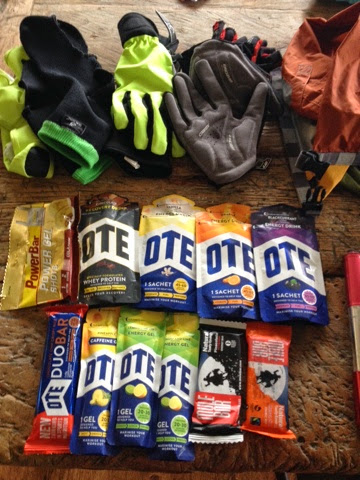
The stuff that will keep me going... hopefully!

Wednesday, 26 March 2014

Endura Trek Lionheart 2014 results as spreadsheet

Here is a link to an Excel spreadsheet (.xlsx) of the results from the 2014 edition of the Endura Trek Lionheart ride, which took place on March 23. I made this mainly because I wanted to see the times in order of the hill climb up King Alfred's Tower, so I could figure out that I was 479th fastest (!) and I make the sheet available for others who may want to play with the data in a way that the racetimingsystems site doesn't cater for.

All I did was cut and paste the data from the pages on their web site and reformat it. Not difficult, but saves you some time. The column 'E/B' is the ratio of the time the rider started the King Alfred's Tower climb to their total time for the ride. In principle this number lets you filter out those riders on 100 mile or km route independently of what route they entered (column 'Entered'), e.g. < 0.4 = 100 miles, > 0.4 = 100 km. Dirty, but should work in most cases.

The link: https://www.dropbox.com/s/jy95yptcoynxwyr/Lionheart2014.xlsx

While you're here, you may want to consider donating money to the NHS, who saved my life and rebuilt my left leg after I was left for dead on a road in 2010. Read the condensed version on the page The Accident & My Leg. Donate by clicking on the justgiving link to the right.

Tuesday, 25 March 2014

Endura Lionheart 2014

On the start line, Longleat House.
I picked the Endura Lionheart as my first race of the year for several reasons: one, I've never been to this part of the country before (rural Wiltshire, nr. Frome); two, I read about it in the book Classic Cycling Race Routes by Chris Sidwell; three, the event centre is Longleat Safari Park (well, OK, Longleat House) and the start goes past the lion enclosure! Lots of good reasons :)

This is my third event raising money for the NHS who saved my life and rebuilt my leg. You can still donate if you follow the justgiving link to the right of this page.

Rebecca and I drove down on the Saturday and stayed in Frome at the Old Bath Arms Hotel which is very quirky - I seem to know how to pick these places - without realising I'd chosen a pub/hotel which has themed rooms! We were in the Hollywood Room which was lovely. I was quite impressed with this place actually. Frome is a town which seems to be on the border somewhere between a tourist place and real life, if you know what I mean. We found a good Italian restaurant, Castello's, across the street from the hotel and then after a pint it was sleep time for me!

Sunday morning and I was up at the crack of dawn raring to go see the lions. Frome is about 5 miles from Longleat so I had decided to bike to the event centre to avoid the stress of parking and getting everything sorted there. I took my time and got my stuff together in the hotel car park, then set off at about 0725 for the event. Found it no problem, only had to look at the map once to make sure I was going the right way.

First thing on getting there - this is a really really good venue for an event centre. There's lots of space, beautiful grounds, the house itself. Top. The weather was OK but it felt like it might become a bit changeable, and so it proved! Because I'd ridden in I just went straight to the start line and queued up. Got underway about 0815. First stretch is through the estate and past the safari park. No animals to see :( Maybe it was too early for them or maybe they don't come near the fences, I don't know. But getting chased off by lions was only a dream after all.

A few miles in, still looking fresh. sportivephoto.com

The first part of this route, the first 40 miles or so, is hilly. Not major climbs, but up-down rolling hills and countryside. Well OK, there's one major climb, King Alfred's Tower, which on this ride was a timed section too. The weather over this first half of the ride was very odd. At one point there were ice crystals coming out of the sky so hard that I had to shield my face with my hand so I could carry on seeing where I was going! It only lasted a few minutes, and thank goodness it didn't happen on a fast descent, but it was pretty mental.

Anyway, I digress, King Alfred's Tower. I don't mind admitting that I look these routes up before I do them, and I tend to make a mental note of any bits of road that have an upward chevron on them on the Ordnance Survey map. This ride had two the second of which was the aforementioned road up to the tower. The tower itself is visible from a lot of the first part of the ride, and it sort of looms in your head, you know that after 32 miles you've got this big hill to get up. I'd never ridden it before, so didn't know really what to expect, but the ride brochure described it as a 'killer climb'. Anyway it was pretty tough, as expected. There was also a car just in front of me to take into account with pacing, as well as people getting off and walking. The climb has three main pitches I would say, and after the second one, when the third and final one came into view, two people in front of me decided they'd had enough. Luckily they were far enough ahead not to bother me as they got off, otherwise I would not have been happy. On this last bit I was just thinking "14 operations, 14 operations" and that got me to the top. My heart rate was at absolute maximum on that last bit. In truth though, my climbing legs may have come back. I wasn't scared of being clipped in like I was on the Ride with Brad last year. I guess I somehow knew that I could get to the top, no matter how bad it got. So it was. I also don't mind admitting that my leg situation spurred me on. I wanted to see people get off and go past them. In the opposite sense, one rider blasted past me right at the top making a lot of noise which made me chuckle. Maybe he was one of the fastest up it, I don't know, I didn't get to see his number :)

After King Alfred's Tower, the emotional side of the ride changed as I began to contemplate the second half. At the second feed station (again I hadn't stopped at the first as per my usual strategy) there was a lot of food and drink, including wine tasting which I don't think I've ever seen before at a sportive feed stop! The feed stops on this ride are billed as being amazing and it's true there was a lot of cake and sandwiches etc. and Haribo! which I love and took a big handful of. I didn't stop long though - I still had my eye on the time and wanted to try to get round in 7 hours. It was already looking doubtful but I decided to push on and see what the state of it looked like at the third and final feed stop at 70 miles.

Wine tasting at a feed station after 48 miles? Surely not!
By this point I was cold and wet, the weather didn't know what to do and I didn't have my jacket with me. So I didn't stop long here, just a toilet break and a refuel. Fortunately the weather settled and I didn't see rain again until the finish. The second half of the route, after the split point, is a long gradual descent along the Nadar Valley and then a long gradual ascent back up the Wylye Valley. Both of these were scenic and enjoyable, even after 50 miles already!

After feed stop 3, I knew my 7 hour target was pretty much impossible, and then getting a puncture after about 72 miles put the tin lid on it. I nearly threw my bike in the hedge at that point, I hate getting punctures, and that's two on the last 4 rides. Bah! I have even now got one of those CO2 inflation things but I didn't use it. I just decided to take my time, eat and drink a bit and press on.

This is the part of these 100 mile rides that I find the hardest psychologically, I know that once I get within 10 miles or so of the finish some adrenalin will kick in, but the hour between 70 and 85 miles is usually pretty tough. As it turned out this one wasn't too bad, the weather held out and the route was interesting enough that my mind didn't go anywhere near a dark place :)

My OTE caffeine gel after 85 miles really picked me up - they are amazing those things - until the finish. The last few miles before the run in to Longleat House were a bit of a tease. You go right past the safari park entrance and then do another couple of miles to arrive round at the driveway into Longleat Estate. I have to say this is probably the best run in to a finish of a sportive I've ever done, right down the perfectly straight driveway to the house. Awesome. That made a brilliant end to an excellent route. Happy :)

Here's a video of the run in from my Virb camera:


Collecting my medal off the nice lady at the finish line.

I find myself wondering about these sportives now that have two route options. I'm sure it used to be that more people did the longer option, but now it seems that after you pass the split point on the long route you barely see anyone. It could be that I'm slower now so everyone's in front of me, I guess I can check the results to see if that's true or not. But it could also be that more people are now doing the short option, which is a shame because I think it has led to the following situation: the first part of the ride is more interesting terrain-wise because everyone does it, then the short route zips back to the event centre, while the long route gets a much less varied extra 40 miles bolted on. I'm not really complaining about the run out along the valley and back, but it was definitely less interesting than the first 40 miles. And I think it was the same on the Wiggle Rut in October.

Having said that I would definitely do this ride again, and recommend it. No wonder it's so popular. Next time though I want to take another day and see the animals myself. I'm a bit jealous of Rebecca's day, and I think she's not a bit jealous of mine ;)

At the finish, Longleat House.
Done the ride, got the T-shirt!

Finally, here's my strava track for this ride. The observant will notice that the moving time was exactly 7 hours! That's quite amazing considering it was my target. If only I could do these rides without stopping :)


Sunday, 27 October 2013

Wiggle KiloToGo The Rut 2013


I've never been to Rutland which is one of the reasons I picked this ride. Rebecca and I stayed in Oakham on the Friday night in the Old Wisteria Hotel. This was a good choice and Oakham it turns out is a good venue for an event centre. We had a good look around on the Friday night, found a quirky Italian restaurant for some pasta dinner, and then Rebecca had plenty of things to do (= shops to look in) on the Saturday while I was out riding.
One of my work colleagues is from Rutland and told me it was pretty flat. Well it isn't. There are no big hills, true, but it is very undulating rolling countryside. This ride had barely a flat section on it, the 102 miles had over 7500 ft of climbing in it! It was a very good route though, quite varied and beautiful scenery throughout.

Plenty of picturesque villages in Rutland.

The weather was windy but dry and quite mild for the time of year. I wore my waterproof jacket but it was too much, and I decided half-way round that I won't be wearing it ever again for biking, it gets pretty sticky and starts to feel like a bin-liner. I'll get one specific for cycling for the future.

The split point. Long route :)

After the split point the number of riders you see drops heavily. I think many more people than before are now doing the shorter options on these sportives. I have mixed feelings about this. Anyway, as usual on these 100 mile routes I started struggling a bit around 70 miles. I hadn't stopped at the first feed station but I stopped at the second for a refuel. They were good and well-stocked with gels and drinks and so on. If I hadn't have stopped it would have been tougher, but of course it ruined my overall time.

There are a lot of rural lanes on this route, but not too rutted or muddy. Perfect!

In the end my moving time was about 6h45m which would have been good enough for a Silver medal on the day, but with feed stops and photo stops and twitter stops I came in in 7h23m which was only good enough for Finisher status. But still, it was a good day in the saddle, and Rutland is worth another trip.

Tired Andrew at the finish.

Here's my strava track for this ride:

Wednesday, 18 September 2013

The Leeds Big Bike Ride 2013

On Sunday I did the Leeds Big Bike Ride, '100' miles for charity - the Leeds Children's Hospital. Thank you to those who sponsored me!

The ride started and finished in Roundhay Park, and there were two route options - 100 km or 100 miles. In actual fact by my GPS the 100 mile option was 98.5 miles. This was a bit of a disappointment in a way since I had hoped this would be my first 100 mile ride since the accident. That will now have to wait until October 26 in Rutland, unless I go and do one round here first of course! I did think about doing a lap of the park at the end to make it 100 miles, but that's not right somehow is it?

For the weekend I had hired a car, to make getting there and back less stressful, and I stayed Saturday night at Clair and Matt's house (Clair is my cousin). That was good too as I got to see them and their new place and Seb of course, their 1-year old son. I got there around 1930 and Matt made us a risotto which was tasty and good carbo-loading for the ride too!

Sunday morning was an early start, 0600 Weetabix and a coffee, then hop in the car to the start. Matt was going to do the 100 mile route with me, but he changed his mind due to the weather forecast (more in a moment) and decided to do the 100 km route instead. It is true that the weather forecast had not been good for Sunday - heavy rain and local gale force winds was the prediction. I was a bit worried to be honest but it would only make it harder, not impossible! And I'm always a bit skeptical about the power of the weather forecast, especially when it's made 4 days out. Even one day out, weather forecasting in England is pretty rubbish. Small land mass, lots of hills, etc etc. 

A look out of the window on the morning suggested it might rain, but it didn't look too bad. It hadn't rained overnight and it wasn't raining currently. About as good as you can hope for! At Roundhay Park it was a simple matter to get my rider number and fix it to my bike. We had to fill in a card and exchange it at the start for the route map. One of my criticisms is that the route was not published, except in cartoon form, ahead of the ride. More on that later!
My lovely Focus bike, ready to go number 260. New bar tape, done by my own fair hand. OTE sports bottles. Lights in anticipation of bad weather!
I had made some allowances for the impending apocalyptic weather though. I put my lights on, just a frog on the front but a proper Cateye one on the back, in case it got really rainy and poor visibility. I used my saddle wedge to put my tools and spare tube in - don't normally do that. It allowed me to wear my Paclite jacket without it getting stretched and uncomfortable around my jersey - the same one I wore for the Ride with Brad, but with hardly anything in the pockets. I put gels and drink sachets in one of the drinks bottles, so I was only carrying one bottle of fluid - the rest stops looked quite frequent (every 17 miles or so) so I wasn't too concerned about that. I put some snacks and my car keys and stuff in my jacket pocket which was a bit bulky but not too bad. Ready to go!
The start line, Roundhay Park.
The ride started off quite simply, a drop out of the park and onto the A58 up the hill out of Leeds. This road I have driven many times in my life on the way back from Manchester to Mum and Dad's before the M62-A1 link (M1) was built. But I've never ridden it obviously because it's quite a busy road! After the roundabout turn right onto a smaller lane, that's better. Matt and his friend Nick had gone off like the clappers and this was the last time I saw them! I had to let them go, they were doing 62 miles and at that pace I would have buried myself in the first 50 of my route. So off they went! On my own, pacing is a lot easier anyway.

The weather wasn't bad at all. It was windy, but so far, dry. The first rest stop that I stopped at was in Naburn, at the pub there (name forgotten!). I ate a chocolate bar and refilled my bottle. If this was repeated at all the rest stops everything would be fine, I felt sure, fluid and food-wise. 

The split point of the route was in York, which we approached from the south through Church Fenton. This was all pretty flat, as expected. In York we did a strange little loop around a roundabout where the shorter route split off, and us 100 milers went for a little cycle through the streets of the city. That was good - I love York, and have been there many times on those streets, but never on a bike. And I knew we'd be coming back to York later on too, so much the better! On the way under the city wall on the way out, it started raining!

Here's me on the start line.
and here's Matt. Sunglasses not really necessary!

I stopped and put the hood of my jacket up under my helmet to keep the water off my head. I started the ride with my new Northwave overshoes on, so my feet should stay reasonably dry and warm. Was this the apocalyptic weather we'd been promised?

Actually it didn't last long. I did get wet, but it wasn't so windy (or was the wind on my back?) and my coat kept me mostly dry. My overshoes were rubbing on my right leg a bit, but not too much. And because I was wearing shorts my feet were getting a bit wet, but it's OK. I'm tough.

North of York I knew that the route entered some less-than-flat country, the Howardian Hills. On the map I had guessed what the route would be from the cartoon map posted on the event web site, and there was only one bit with a chevron, somewhere around Sheriff Hutton (that's a place). There was indeed a bit steep bit, called Bulmer Bank, but it wasn't very long so I could muscle up it without too much difficulty. Some people were walking though, so this represents progress for me! After a further rest stop there was another steep bit called Dalby Bank, but again, I got up it without much of a struggle. Apart from rolling hills, these were the only steep bits of the ride, but I knew that it would be mostly flat, that was part of the reason for doing this one before Wales.

There were some really nice country lanes up there, and so it was a bit of a shock when the route dumped out on to a busier road, turned left at a sign saying York 13 miles, and I realised that I'd be on this road all the way back to York. Plus, there was a headwind. I had had a feeling that the wind had been on my back because the speed was quite high for not really pushing hard. And so it was that the next 13 miles were quite tough, this road has some long straight sections where basically I put my head down and got on the drops to try to minimise my cross section and reduce drag. But it was doable, and I managed to maintain 13-15 mph throughout. I did bemoan the choice of route several times though - long straights are bad enough at the best of times but worse when you're riding into the wind! At least it wasn't raining!!

Back into York, along the road that Mum and Dad always use that goes past the hospital, the same fun was experienced riding round those streets. The route went towards the station but made the sharp left after the bridge down by the river side and passed by The Maltings, one of my favourite pubs. I did stop to take a picture, and the thought of a pint flashed across my mind for a super split-second. Not today :)

After returning to York the route had us go to Tadcaster and then back to Roundhay Park. In Tadcaster I stopped at the rest stop and took the last of my energy stuff, save for one emergency gel just in case. I didn't realise how hilly it was between Tadcaster and Leeds. I remember thinking that Leeds wasn't at the top of a hill surely, so the downhill had to come sooner or later. Eventually it did come and I was back on the A58, the same road I'd left Leeds on, 7 hours earlier.

As I said, in Roundhay Park I did consider putting a loop in to make it 100 miles, but I didn't. There was a medal and certificate and a bottle of water. My bike looked like it had been off-road it was so covered in dirt from the wet roads. But I had finished the ride, in a reasonable time considering most of the second half was into a headwind, and it was another target reached, well, almost.

It did rain, I did get wet and it was very windy at times, but the weather warning stuff never came. Probably just as well but it goes to show you can't tell, the day before, let alone 4 days out.


Afterwards, after I had got dried and changed in the car, I went back to see Clair and Matt for a coffee. I was tired and needed a caffeine boost to get home safely! It turned out that Matt had been the first finisher for the 100 km! The winner. Just tells me really he should have been on the long route :)

When I got home I had a nice hot shower and some food. My scale told me I was 5 pounds lighter than I was on Saturday when I left. Cool!

Overall, I was pleased with this ride from my own body / recovery point of view, but in all honesty I was a bit disappointed with the route. It was for charity, of course, so I will keep my moaning to the minimum, but it was organised by an experienced bike event company, so I would have expected a slightly better (cycling-wise) route than the one we got. It was billed as being mostly on country lanes, and there were some lovely bits, but for me there was too much on busier roads - even if they're B-roads. The Howardian Hills are lovely and I have never biked there before. And riding through York was fun - I would do both those bits again happily. But over the rest of the course there was too much turning the pedals and not really enough to see! I'm sure one could come up with a 100 mile route starting and finishing in Roundhay Park which was much more interesting than that one. And if I'd designed it, it would have definitely been 100 miles long!

But as I said, it was for a very good cause, and I hope they raised a lot of money. I heard that there was about 1000 riders on Sunday. That seems high to me, I didn't see a whole bunch of people at the start, finish or going round, but maybe the majority were on the 100 km and they left after me and finished before me, it could be.

Would I do this one again? No, not unless they change the route. Maybe next time it could go the other way up to Harrogate and Ripon? Or towards Skipton and the edge of the Dales?

And a 100 mile ride has to be 100 miles. Sorry, it just has to be.

Next? The Autumn Epic on October 6, 95 miles but in the hilly Welsh Marches and Elan Valley.

Monday, 19 August 2013

Evidence of Improvement

Those who know me will not be at all surprised to learn that I keep meticulous records of my bike rides! At the outset of my cycling recovery, which started in January, I decided to ride a few routes which I could use at subsequent points in time to measure how I was improving. These rides would not be long - they couldn't be because I had to be able to do them at the beginning! But they would be reasonably all-out efforts, on as similar equipment as possible.
I now have data for three rides on two of the routes, and here is one of them, I call it Torkington Road Loop CW (clockwise). Briefly it is the descent and pull up from my house to the A6; the A6 to Hazel Grove; Torkington Road to Hawk Green and then Marple back to New Mills via Strines. It's 14 miles. There is a long descent between Disley and Hazel Grove, and a long ascent between Hazel Grove and Hawk Green. Here is a map:

Map of test route Torkington Road Loop CW.
I use the program myTourBook for recording my rides offline and Strava for online.

I did this route on January 15 2013, it was the fourth ride I did after returning to action, on my old mountain bike. I did it again on April 14 and again yesterday, August 18 2013.

The numbers in the following table come from my GPS and from Strava. The speed, power and heart rate are the averages for the ride. Weight is the weight of everything out of the door, i.e. me plus bike and stuff in pockets.

DateMoving timeWeight (kg)Speed (mph)Power (W)Heart rate (bpm)
January 151:12:1797.711.7167175
April 141:02:0593.513.6212179
August 180:54:1293.015.6253171

To be honest I wasn't really expecting such a big change yesterday. I felt pretty tired straight out of the door from the ride I did on Saturday. I knew on the gradual ascent between Hazel Grove and Hawk Green that I was a lot stronger though - the first time I did this ride that road seemed very hard. Yesterday it was not as bad and I managed to push all the way. I didn't use the small chainring at all yesterday. I knew I would knock off a few minutes but I'm surprised and very happy it was 8. That's over 30 seconds per mile :)

I think it's also interesting that my average heart rate is down as well. You can also see my body changing from the following histograms. Not sure what a sport scientist would make of these, but to me it looks like a pretty significant improvement when taken together with the times and power outputs.